US Braces for Another Round of Severe Weather Next Week
The severe weather threat is moving eastward as Multiple states across the US experienced severe thunderstorms in May, leading to significant damage. These powerful storms brought flooding in Iowa, unusually large hail in Texas, and deadly tornadoes, including EF-4 tornadoes, during the Kansas outbreak. States such as Texas, Louisiana, Oklahoma, and Iowa bore the brunt of these storms that witnessed high winds, hailstones, tornadoes and flooding.
The Storm Prediction Center has identified areas in Nebraska and Iowa as having high potential for severe weather, although a broad part of the country, especially over the Plains, A tornado in Jackson County, Oklahoma, near Olustee, caused widespread power outages. Additionally, Nebraska experienced softball-sized hail, while baseball-sized hail was reported south of Interstate 40 in southwest Oklahoma on Friday evening.
Severe weather is likely to persist throughout the Memorial Day weekend, with risks of large hail, damaging winds, and tornadoes extending from Texas to the Northeast. New severe weather fronts are forecast from the Dakotas down to Texas. The Storm Prediction Center rates cities like Oklahoma City and Wichita, Kansas, Level 3 out of 5 for thunderstorm severity.
Moreover, the Storm Prediction Center has marked Nashville, Tennessee, and Louisville, Kentucky, as facing the highest risk but has also warned of potential thunderstorms in cities from St. Louis, Missouri, and Little Rock, Arkansas, to Chicago and Columbus, Ohio.
US Braces for Another Round of Severe Weather Next Week: Actionable Insights on EigenPrism
Post Event
Flood
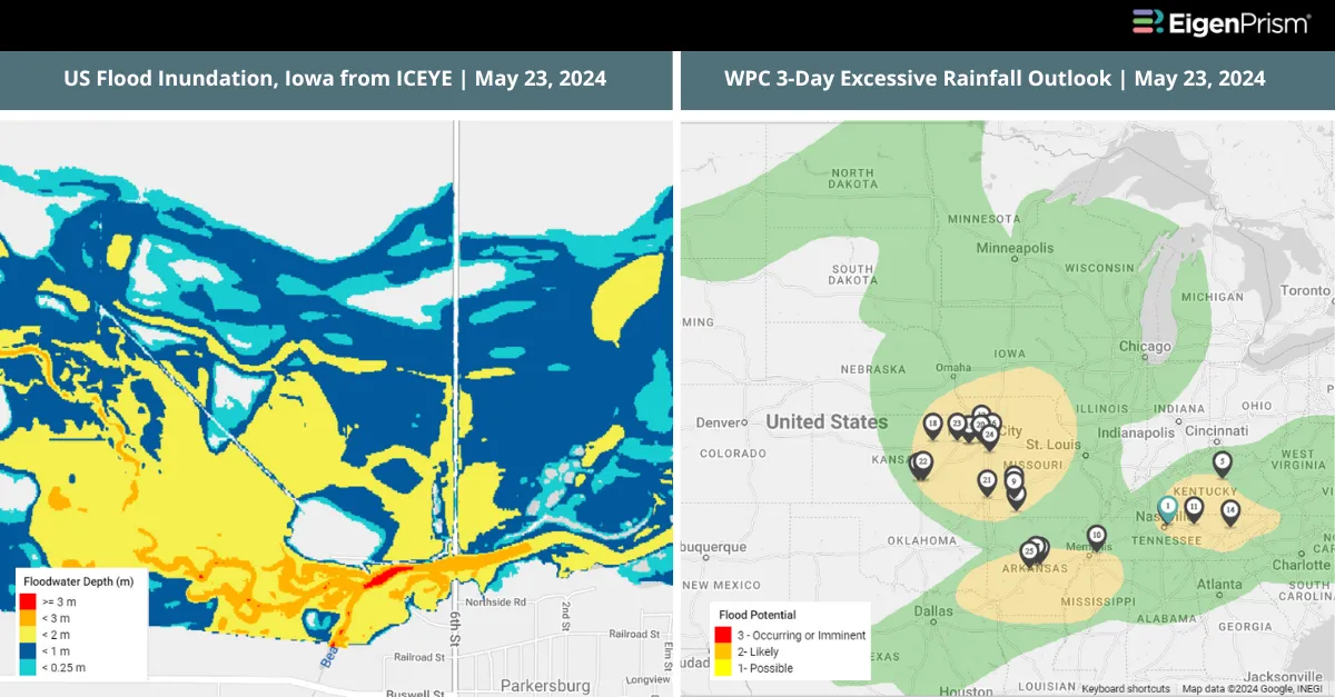
Subscribers of ICEYE can use this real-time footprint on EigenPrism® to quickly assess the impact of flooding:
Flash Flood – USA Northern Plains 2024 – Flood Inundation as of 024-05-23
All EigenPrism® users can assess the post-event impact of tornadoes and hail using the following report template:
US Tornado & Hail May 23, 2024 Post Event Impact Report
This report template contains the latest available footprints, which include:
- 24-Hr Tornado Report Ending
- 24-Hr Rotational Track
- 24-Hr Hail Swath Ending
Note: Tornado damage survey footprints are typically released by NWS a few days after the event and will be available in EigenPrism as soon as they are released.
Tornado, Hail, & Wind
Subscribers of Canopy Weather in EigenPrism can assess the impact of the tornado, hail, and wind from May 23, 2024, using these latest available footprints within EigenPrism®
US Tornado Proximity Map as of 2024-05-23
Daily CONUS Peak Wind Gusts as of 2024-05-23
Daily CONUS Hail Swath Map as of 2024-05-23
Forecast
All EigenPrism® users can assess the forecast of this multi-peril event using the following report template:
US Severe Weather 2024 Forecast Report
The report template auto-updates with the latest available footprints, which include:
- Significant Tornado Day 1 Outlook
- Significant Hail Day 1 Outlook
- Significant Wind Day 1 Outlook
- WPC 3-Day Excessive Rainfall Outlook
- NA 5-day Flood Potential
- NA 3-day Flood Potential
- US Flood Outlooks
Escape the News Cycle | Get Alerts Automatically For Events Impacting Your Assets
With EigenPrism Alerts, you can set Alerts and free yourself from constant event monitoring. Set up personalized alerts based on predefined impact thresholds and choose how you receive them – via email, SMS, or directly within EigenPrism. This way, you stay informed on your own terms, focusing only on the events that truly matter to your assets.
Set your alerts now.
Don’t have access to EigenPrism®?
Sign up for a trial account and access full impact reports of all events. Contact us, and we’ll set up a trial account for you.