
20 Years of Hurricane Katrina: A Legacy of Loss and Lessons
August 29th marks the 20th anniversary of Hurricane Katrina, a catastrophic storm that reshaped New Orleans and left a lasting mark on the Gulf Coast. Hurricane Katrina remains one of the deadliest and most expensive natural disasters in US history, with damages estimated at over $125 billion in 2005, equivalent to $206.8 billion in 2025 dollars based on standard CPI adjustments.
Making landfall near Buras, Louisiana, on August 29, 2005, Katrina’s 125 mph winds and a storm surge peaking at nearly 28 feet overwhelmed the levee system, devastating New Orleans, Louisiana, and coastal Mississippi. Yet, fewer remember that Katrina’s destructive journey began earlier that same week, when it first struck southern Florida as a Category 1 hurricane just south of Miami.
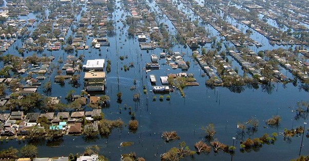
By August 31, 2005, nearly 80% of New Orleans was submerged after levee breaches triggered catastrophic flooding. Wind gusts topped 100 mph, neighbourhoods were inundated, and infrastructure collapsed. Tragically, an estimated 1,392 lives were lost due to the hurricane and subsequent flooding.
Was Katrina a Once-in-a-Lifetime Event?
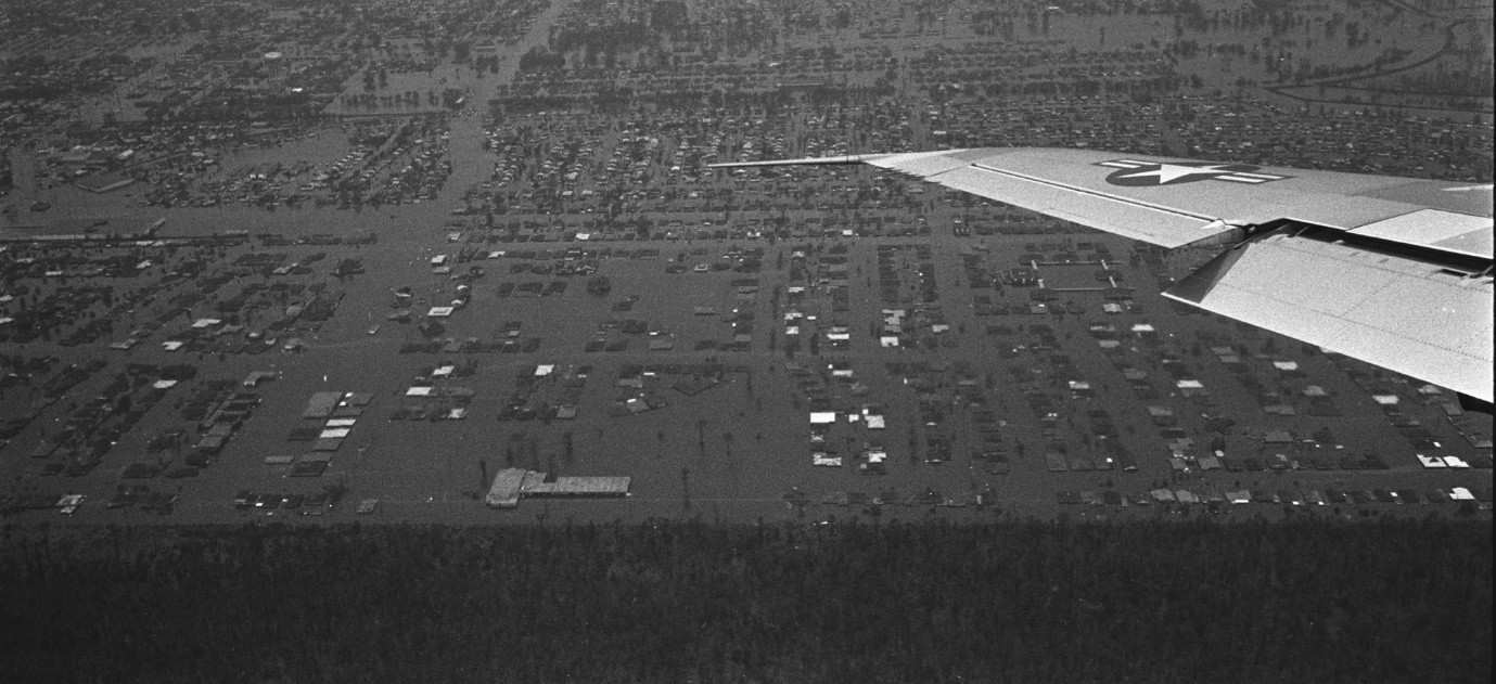
Unfortunately, no. History offers a sobering reminder in the form of Hurricane Betsy. Sixty years ago, on September 9, 1965, Betsy made landfall near New Orleans as a Category 4 hurricane after first sweeping across southern Florida. Much like Katrina, Betsy’s massive storm surge breached levees and inundated neighborhoods, causing widespread destruction. Betsy also became the first Atlantic tropical cyclone to cause over $1 billion in damage.
How EigenPrism can help me assess the impact of Katrina on my exposure today?
In 2005, available hurricane data primarily focused on the wind field. Publicly available data for storm surge was not available.
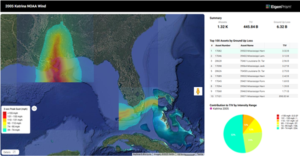
To evaluate the impact of wind, all EigenPrism users can overlay historical Katrina wind footprints from NOAA & Hurricane Mapping.
In addition, premium subscribers of Katrisk and Reask can leverage their high-resolution Katrina wind footprints in EigenPrism.
As we learned from Katrina, storm surge caused the most catastrophic damage. Subscribers of Katrisk can access their high-resolution storm surge footprint for Katrina (as well as Betsy).
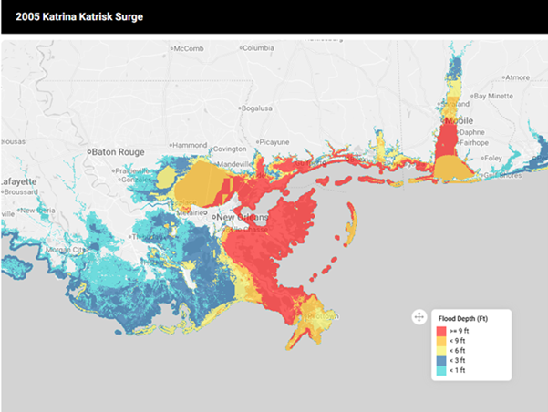
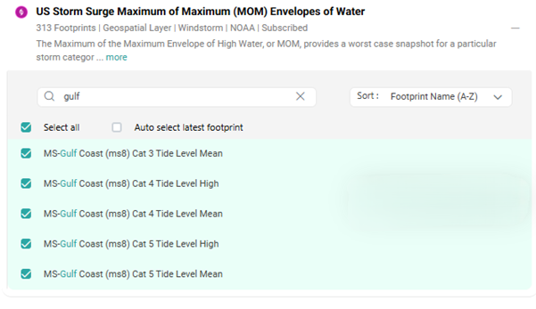
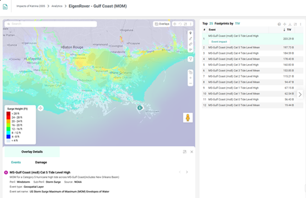
Although a storm surge footprint for Katrina isn’t available from NOAA, they have developed a variety of storm surge data products that all users in EigenPrism can utilize. For example, in the model catalog under Hazard Maps, the US Storm Surge Maximum of Maximum (MOM) Envelopes of Water event set has Gulf Coast storm surge footprints that provide a worst-case snapshot for different storm categories and tide levels. Pick a particular footprint or run all of them in an EigenRover analysis.
How EigenPrism can help you better prepare for Hurricane Season?
Since Hurricane Katrina, there have been significant advances in analytical tools and data to help you manage your hurricane risk, both pre- and post-landfall.
Through EigenPrism, users have the ability to access a variety of free and premium storm footprints, high-resolution imagery, and damage estimates.
To know more about how EigenPrism can help you prepare for hurricane season, read our blog.
What’s Next?
Already a client?
Log into EigenPrism and run a scenario simulation today.
Want to see how it works?
Request a demo and we’ll walk you through your own exposure data live.