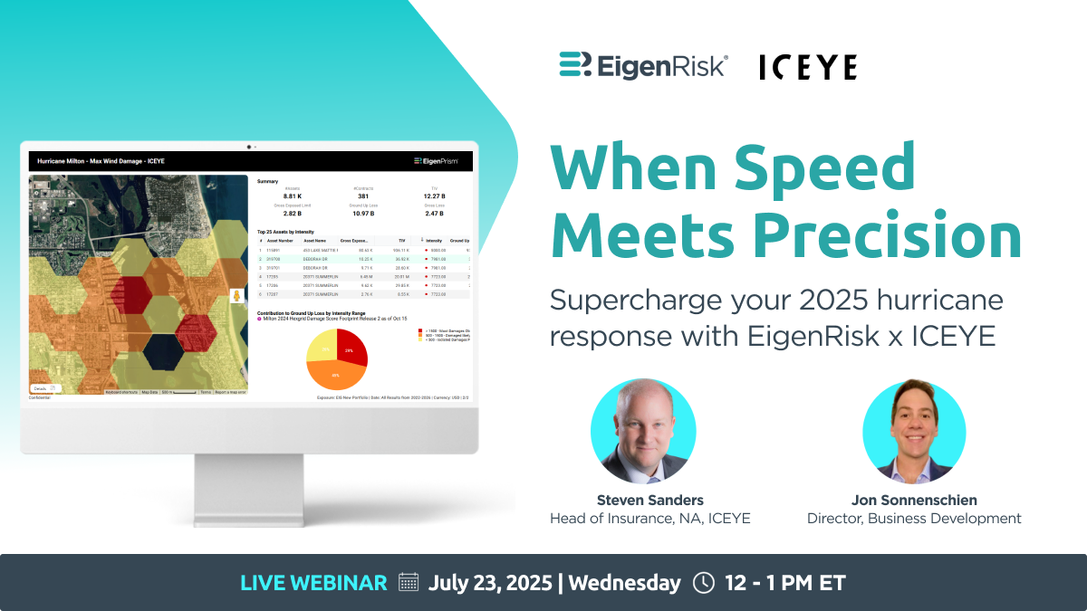
When Speed Meets Precision
Supercharge your 2025 hurricane response with EigenRisk and ICEYE.
As insurers prepare for the peak months of the 2025 Atlantic Hurricane season, satellite-based resources available on the EigenPrism risk management platform tools can help them respond to events faster and with greater precision.
In a timely new webinar, Steven Sanders, Head of Insurance for North America at ICEYE and Jon Sonnenschein, Director, Business Development at EigenRisk, examine the challenges posed by hurricanes and show how insurers can leverage new solutions to respond more effectively.
Headquartered in Finland, ICEYE has employees in 60 countries and operates the world’s largest constellation of satellites equipped with synthetic aperture radar (SAR).
Whenever and wherever a weather-related disaster occurs, ICEYE satellites equipped with SAR can capture and disseminate granular images of properties regardless of atmospheric conditions, such as nighttime darkness, clouds, smoke, wind and rain. In January, this capability proved critical during the Los Angeles wildfires.
With its ability to capture granular images of damaged or destroyed properties and transmit them quickly to partners, ICEYE serves the needs governments, emergency responders, and insurance companies seeking timely and accurate information on the impact on their portfolios of flooding, wildfires, and hurricanes.
Sanders said ICEYE can deliver data within 24 hours showing the extent of flooding and depth at specific locations. During wildfires, ICEYE can detect through smoke whether a building has been damaged or destroyed.
ICEYE’s hurricane solution identifies damaged and destroyed properties through change detection, which contrasts pre-event and post-event imaging. In effect, to determine the location and extent of hurricane damage, ICEYE compares pre-event property images and compares them with post-event views.
At the start of the 2025 Atlantic Hurricane season ICEYE has covered entire U.S. Eastern coastline to develop an effective catalog of pre-event images for comparison purposes. In addition, as hurricanes develop and paths are forecast, ICEYE conducts additional pre-imaging only days prior to landfall. The images display what the ground looks like before an event and compares them with images generated within 24 hours of its aftermath.
Hurricane response: Assessing aerial vs. satellite-based resources
In comparing aerial observation resources to satellite capabilities, Sanders explained there are limitations on when and where aircraft can be deployed. Hurricane-force winds, heat from wildfires, smoke and other atmospheric conditions can prevent or delay the deployment of aircraft to areas affected by storms and other climate- and weather-related disasters. On the other hand, satellites equipped with SAR aren’t subject to those restrictions.
Furthermore, satellites can fly over and view much larger areas in comparison to what can be covered in compress timeframes by aerial solutions. ICEYE’s approach also provides current pre-event views, which can be as recent as one day prior to landfall. Finally, its output also includes the impact of flooding.
For claims managers, the ability to assess wind and flood damage within 24 hours of an event facilitates the ability to triage the deployment of adjusters and specialists to specific locations based more precisely on required skill sets and experience levels.
Sanders then reviewed ICEYE’s response to Hurricane Helene. Satellites were able to map 5,800 square miles affected by the storm and 165,000 buildings impacted, particularly properties located outside flood zones.
Notably, using data generated by ICEYE, a U.S. insurer was able to resolve approximately 500 claims from Hurricane Helene within 72 hours. The precision of the data provided by ICEYE enabled the insurer’s adjusters to deploy and focus on claims specifically where they were most needed.
Discerning damage from back-to-back events
Another benefit of leveraging satellite-based technology for large-scale disasters is the ability to identify damage resulting from consecutive events. In 2024, within two weeks of Hurricane Helene, Hurricane Milton struck some of the same areas.
ICEYE generated pre- and post-landfall images for Helene, which were also used to assess and delineate damage resulting from Hurricane Milton based on a comparison with its post-event imaging. Images captured from Hurricane Milton were disseminated to insurers within a 24-hour period and flood insights were generated within hours of landfall.
Sanders and Sonnenschein then demonstrated how ICEYE was accessed and integrated with location and financial data on EigenPrism to identify property damage, prioritize by TOV and respond to Hurricane Milton in 2024.
First, they used a hex grid with a heat map showing storm intensity and insured locations to help pinpoint where an insurer might prioritize its response efforts. They were able to pan areas and zoom into specific locations to check for wind damage and then do the same for flood. For illustrative purposes, damage identified through the satellite images was validated using aerial views, which weren’t available until days later.
Hurricane season checklist preview
Sonnenschein concluded with a preview of EigenRisk’s hurricane season checklist, including the following three steps:
1. Update your exposure data now- Incomplete or outdated SOVs create gaps in every alert, estimate or report that follows.
2. Set event-specific thresholds- Tailor alert settings to what matters most – TIV, policy limits, or specific layers of interest. For instance, EigenRisk offers an automated alerting system that allows users to set how and when they receive alerts as well as to establish criteria for generating them.
3. Test your internal reporting workflow- Run a mock event and send a sample impact report to your team. See what breaks before it matters and try to rebuild as needed.
Want to learn more?
To access the webinar, click here. To learn more about EigenRisk platform, please contact us: