Feb 14 | Cyclone Zelia Makes Landfall as a Category 4 Storm in Western Australia, Bringing Devastating Winds and Heavy Rainfall
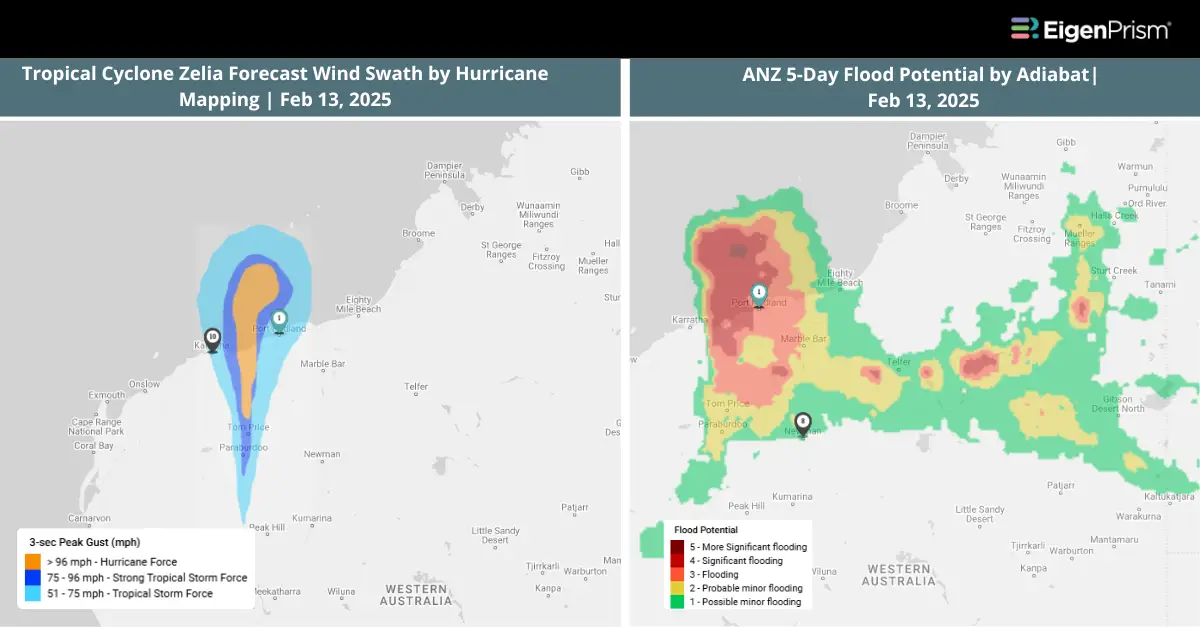
Tropical Cyclone Zelia made landfall earlier than expected near the De Grey River mouth, northeast of Port Hedland, at category 4 intensity. It is now moving to the south over the inland eastern Pilbara. Port Hedland is experiencing severe winds but has avoided the very destructive core of the cyclone.
The Bureau of Meteorology (BOM) has warned of intense rainfall, forecasting 200 to 300 millimeters over the next 24 hours, with an increased risk of flash flooding. Winds near the cyclone’s center could reach speeds of 250 km/h, posing a serious threat to communities in its path. The storm has already damaged mining giant BHP’s $130 million dust fence in Port Hedland.
Actionable Analytics on EigenPrism
Forecast
Windstorm and Flood Dataset
All EigenPrism® users can assess the forecast of the tropical cyclone using the following report template:
Tropical Cyclone Zelia, Feb 2025, Forecast Impact Report Template
This report template enables you to assess the forecast of the tropical cyclone based on the footprints from Adiabat & Hurricane Mapping. The footprints display the following: Tropical Cyclone Forecast: Wind Swaths and 5-Day & 3-Day ANZ Flood Potential. The pages auto-update with the latest available data.
Post-Event
Windstorm Dataset
All EigenPrism® users can assess the impact of the tropical cyclone using the following footprint:
Zelia Past Wind Swath by Hurricane Mapping as of Feb 13, 2025
All EigenPrism® users can assess the impact of wind gusts using the following footprint:
Daily Peak Wind Gust across ANZ by Adiabat as of Feb 13, 2025
Alerts
Users who have alerts set on their exposures for the relevant event sets, like those from NWS & Canopy Weather will receive alerts (if the event footprints impact these exposures).
To learn more about how to set an alert on a specific event set, check out this help center article.
Feel free to contact us at Prism.Support@eigenrisk.com or reach out directly to your Customer Success Manager with any questions or concerns. Our team is here to assist you with setting alerts, understanding report templates, and maximizing the actionable insights available through EigenPrism®.
Feb 12 | Tropical Cyclone Zelia Intensifies, Bringing Heavy Rain and Flooding Threat to Western Australia
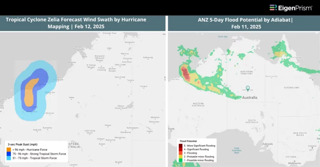
Tropical Cyclone Zelia advances toward the Western Australia coast, bringing damaging winds and over 500mm of rainfall. Authorities warn that flooding poses a major threat to inland communities, with heavy downpours already recorded in some areas. Places like Port Hedland received 75mm of rain while Pardoo recorded 82mm of rain. The system is expected to make landfall near Port Hedland on Friday.
According to meteorologists, Cyclone Zelia is forecast to strengthen to a Category 3 system by Thursday as it nears the coastline. The Bureau of Meteorology warns that intense rainfall beginning Wednesday night may lead to dangerous flash flooding in coastal and adjacent inland areas between Bidyadanga and Port Hedland, with wind gusts reaching speeds of up to 160kph.
Actionable Analytics on EigenPrism
Forecast
Windstorm and Flood Dataset
All EigenPrism® users can assess the forecast of the tropical cyclone using the following report template:
Tropical Cyclone Zelia, Feb 2025, Forecast Impact Report Template
This report template enables you to assess the forecast of the tropical cyclone based on the footprints from Adiabat & Hurricane Mapping. The footprints display the following: Tropical Cyclone Forecast: Wind Swaths and 5-Day & 3-Day ANZ Flood Potential. The pages auto-update with the latest available data.
Post-Event
Windstorm Dataset
All EigenPrism® users can assess the impact of the tropical cyclone using the following footprint:
Tropical Cyclone Zelia Past Wind Swath by Hurricane Mapping as of Feb 12, 2025
All EigenPrism® users can assess the impact of wind gusts using the following footprint:
Daily Peak Wind Gust across ANZ by Adiabat as of Feb 11, 2025
Alerts
Users who have alerts set on their exposures for the relevant event sets, like those from NWS & Canopy Weather will receive alerts (if the event footprints impact these exposures).
To learn more about how to set an alert on a specific event set, check out this help center article.
Feel free to contact us at Prism.Support@eigenrisk.com or reach out directly to your Customer Success Manager with any questions or concerns. Our team is here to assist you with setting alerts, understanding report templates, and maximizing the actionable insights available through EigenPrism®.