Tornado and Hail Threats, as Severe Thunderstorm Likely to Impact the Central and Southern US
A significant weather event is likely to produce severe thunderstorm in Central and Southern US beginning late Tuesday. As per the reports, the system could bring large hail, isolated tornadoes, along with threats of damaging winds. It may eventually cause heavy rain threats in parts of Texas.
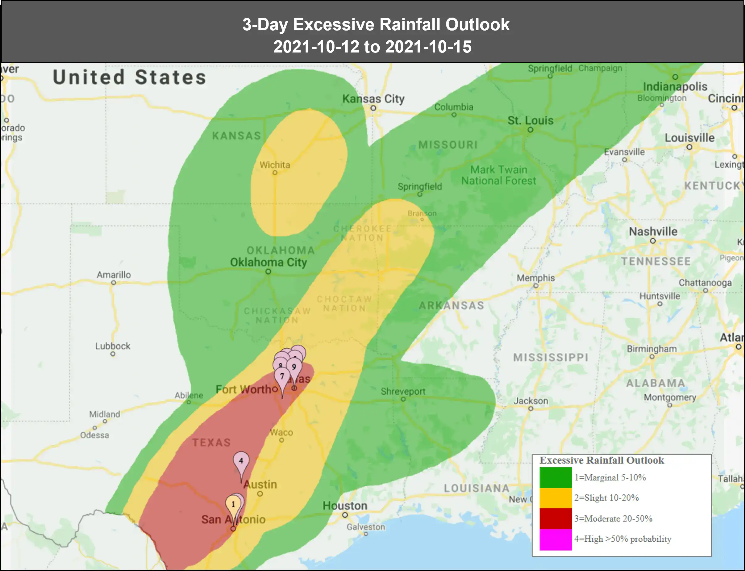
For now, the most likely areas to witness severe thunderstorm ranges from – Nebraska into Kansas, Oklahoma and northwest Texas. However, the major impact could be caused by flooding rainfall in parts of Texas, as the moisture along this front will be enhanced by Hurricane Pamela in the Eastern Pacific. Heavy rain of 2 to 5 inches in some areas is likely to fall, from late Wednesday into Thursday.
This is the second wave of severe thunderstorms to impact the Plains and Midwest this week. An initial disturbance produced severe weather from the Southern Plains into the Ozarks on Sunday night. As a result, there were nearly a dozen of tornadoes from Oklahoma into southwest Missouri, that caused damage to property and infrastructure in Tulsa and Oklahoma.
Assessing the impact
EigenPrism users can access the following quick links for the severe thunderstorm in Central US and Southern US. You can immediately overlay the event footprints on your exposure:
- Significant Tornado Outlook – valid from 2021-10-12 to 2021-10-13
- 24-Hr Hail Swath– ending 2021-10-12
- Significant Wind Outlook – as of 2021-10-11
- 3-Day Excessive Rainfall Outlook – valid from 2021-10-12 to 2021-10-15