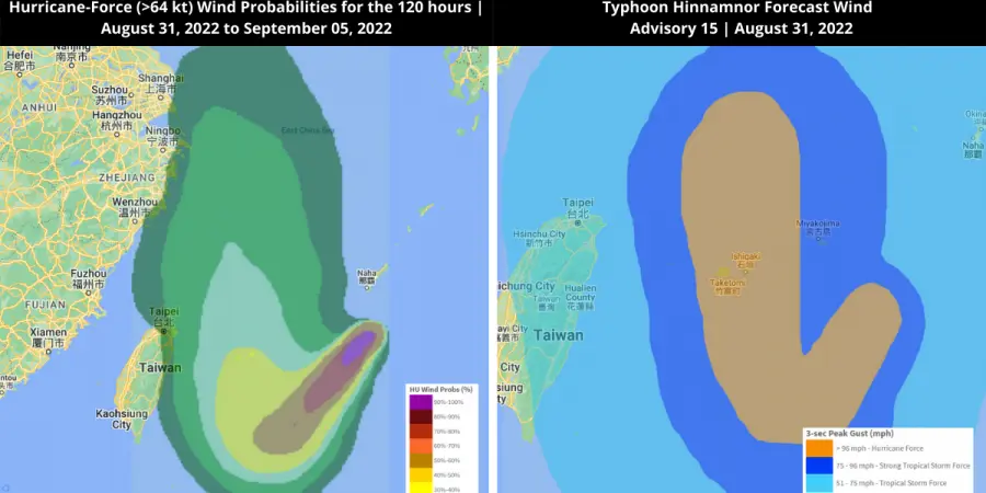
Super Typhoon Hinnamnor approaches East China Sea and Japanese Islands
Super Typhoon Hinnamnor, predicted to be the most powerful storm of 2022, is intensifying over the South China Sea. The typhoon is anticipated to reach the east coast of China and the southern islands of Japan.
According to meteorological predictions, Super Typhoon Hinnamnor is gathering sustained winds of 144 mph and gusts of 195 mph, making it comparable to a category-5 hurricane.
The typhoon has hampered travel to Japan’s Okinawan islands and is expected to make landfall on coming Wednesday. In light of the typhoon’s projected path, Japan Airlines Co. and ANA Holdings Inc. have canceled a number of flights to and from Okinawa and issued cancellation and delay advisories for further flights.
The typhoon in the East China Sea is predicted to approach from the north. Despite the fact that it is unlikely that the storm would impact China, the nation is making preparations just in case. The Ministry of Emergency Management has issued warnings for coastal regions, including Zhejiang and Fujian.
Assessing the Impact
EigenPrism® users can access the following quick links to the Super Typhoon Hinnamnor track. You can immediately overlay the following footprints on your exposure: