Severe Weather Submerges Houston While Tornadoes Ravage Central Texas
The Houston area is currently experiencing flooding while severe weather continues tormenting other states across America. A flood watch remains active through Friday for southeastern Texas and Louisiana, with numerous flash flood warnings in effect due to 8 inches of rain, which drenched parts of southeastern Texas on Thursday. More rain is anticipated to hit the region in additional rounds through Friday.
Harris County officials have declared a disaster and issued mandatory evacuation orders for residents near the East Fork of the San Jacinto River, where ongoing flooding and rainfall in north of the area have significantly raised water levels. The river is projected to rise to 77 feet above sea level by Friday, prompting concerns about further inundation.
Transportation disruptions are widespread, with sections of U.S. Highway 59 in Polk completely shut down due to the floods, as the state Transportation Department reported. As of Thursday morning, more than 7 inches of rain had already fallen in Harris County, with the National Weather Service extending a flood watch for Houston until 7 p.m. Friday. Although heavy rains subsided by late Thursday afternoon, the flood risk persists, with slow drainage in Northern Houston, including the Kingwood area.
The severe weather has affected Texas and other states across America, with Thursday seeing nearly 100 reports of severe conditions, predominantly in Texas. The most severe impacts were recorded in rural towns like Hawley and Hamlin in west-central Texas, where videos captured extensive damage and storm chasers searched through debris. The local school district reported that several families lost their homes during the storm.
A significant tornado was also reported in Central Texas, near Abilene in Jones County, highlighting the widespread nature of the severe weather. As the weekend approaches, scattered strong to severe thunderstorms loom over the central and southern Plains from late Friday into Saturday morning. These storms may bring large hail, damaging winds, and the possibility of an isolated tornado.
Severe Weather Submerges Houston While Tornadoes Ravage Central Texas: Actionable Insights on EigenPrism
Post-event
Tornado & Hail
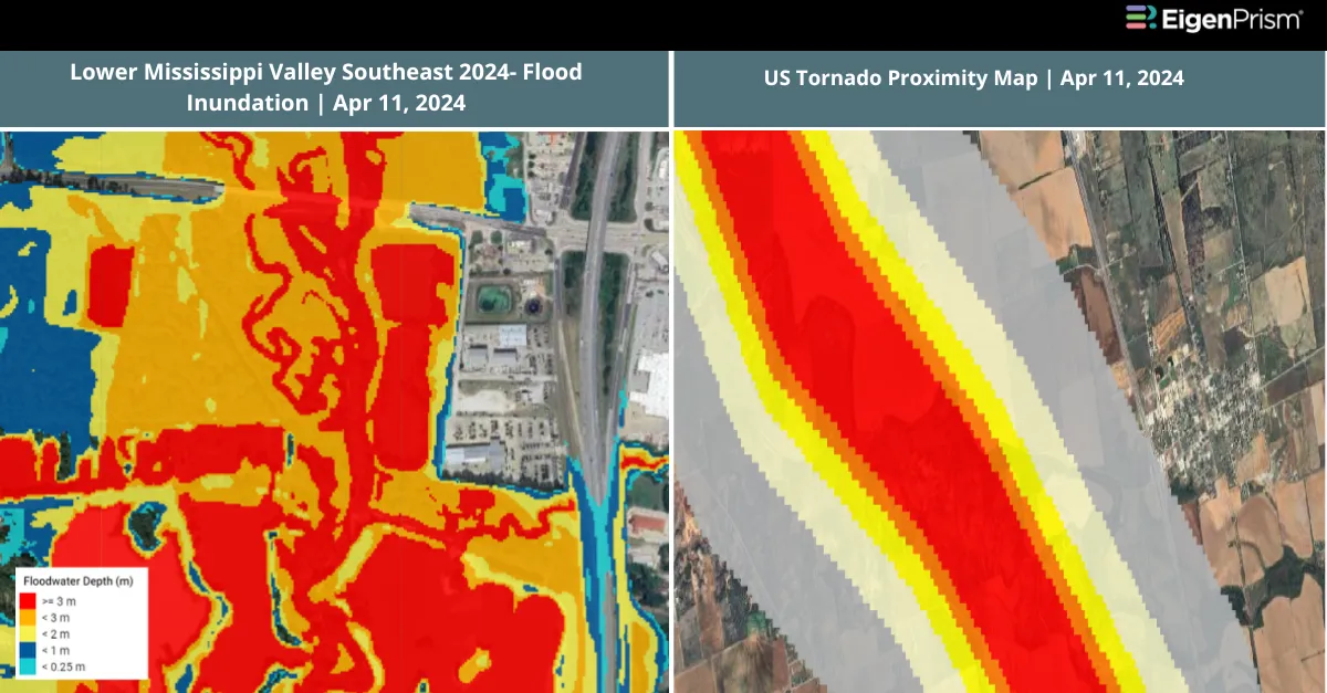
Subscribers of Canopy Weather in EigenPrism can assess the impact of the tornadoes and hail from May 02, 2024, using these footprints within EigenPrism®
US Tornado Proximity Map as of 2024-05-02
Daily CONUS Hail Swath Map as of 2024-05-02
Note Damage survey footprints will be available as soon they are released by NWS.
Flood
Subscribers of ICEYE can use these real-time footprints on EigenPrism® to quickly assess the impact of flooding:
Flash Flood – USA Central (USA) Arkansas, Oklahoma, Texas 2024 – Flood Inundation as of 2024-05-02
Forecast
Flood
All EigenPrism® users can assess the forecast of flooding using the following report template:
The report template auto-updates with the latest available forecasts, which include:
- WPC 3-Day Excessive Rainfall Outlook
- US Flood Outlook
- NA 5-day Flood Potential
- NA 3-day Flood Potential
Hail
All EigenPrism® users can assess the forecast of Hail using this footprint within EigenPrism®
Significant Hail Day 1 Outlook as of 2024-05-03
Escape the News Cycle | Get Notified Automatically for Events Impacting Your Assets
With EigenPrism Alerts, you can set Alerts and free yourself from constant event monitoring. Set up personalized alerts based on predefined impact thresholds and choose how you receive them – via email, SMS, or directly within EigenPrism. This way, you stay informed on your own terms, focusing only on the events that truly matter to your assets.
Set your alerts now.
Don’t have access to EigenPrism®?
Contact us if you want to learn more