New York and Pennsylvania Brace for Heavy Snow and Rain as Winter Storm Disrupts Thanksgiving Travel
A powerful winter storm system is sweeping across the Northeast, bringing snow, much-needed rain, and strong winds as millions prepare to travel for the busy Thanksgiving holiday. According to forecasters, some areas could receive up to 8 inches of snow, while others will benefit from several inches of rainfall.
The National Weather Service (NWS) office in Binghamton, New York, has described the storm as a potential “high-impact winter storm” in its Wednesday forecast discussion. Winter storm warnings have been issued for parts of New York, with heavy snowfall expected in several regions.
In New York City, nearly an inch of rain fell on Thursday, with additional showers expected. Meanwhile, western Sullivan County and the Poconos could see snowfall totals ranging from 4 to 8 inches. This banding could follow Interstate 86 into Broome County, New York, overnight.
Under these snow bands, snowfall rates could reach 1 to 3 inches per hour for extended periods, according to the NWS. Northeastern New Jersey and the lower Hudson Valley are under advisories, with some areas anticipating a mix of snow and rain. Northeastern Pennsylvania and the Catskills in New York are expected to experience the heaviest snowfall, with accumulations of up to a foot possible in higher elevations.
New York and Pennsylvania Brace for Heavy Snow and Rain: Actionable Analytics on EigenPrism
Post-Event
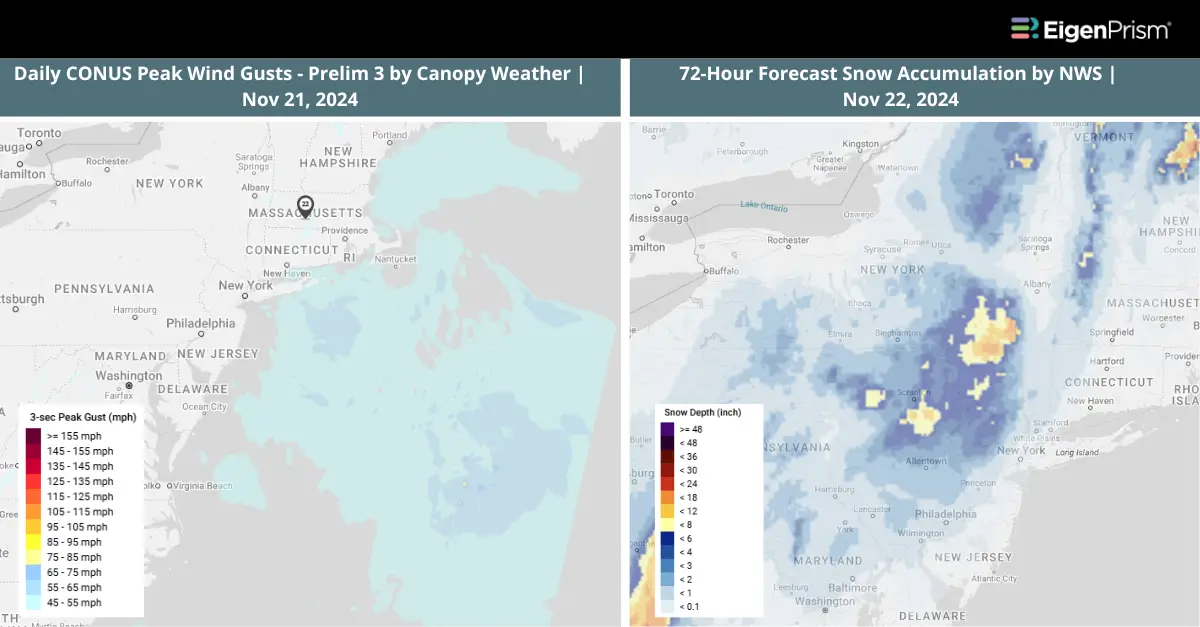
All EigenPrism® users can assess the post-event impact of the snow accumulation and wind using the following event footprints:
72-hour observed snow accumulation as of Nov 22, 2024 by NOHRSC
Daily Peak Wind Gust across North America as of Nov 21, 2024, by Adiabat
Canopy Weather
Subscribers of Canopy Weather can assess the impact of Winds from Nov 21, 2024 using this footprint within EigenPrism®:
Daily CONUS Peak Wind Gusts- Prelim 3 as of Nov 21, 2024
Forecast
All EigenPrism® users can assess the forecast of this event using the following report template:
US Winter Storm Forecast Report Template
The report template auto-updates with the latest available forecasts, which include:
- 72-hr Forecast Snow Accumulation by NWS
- 72-hr Forecast Freezing Rain Accumulation by NWS
- Potential Winter Storm Overall Impact by NWS
Escape the News Cycle | Get Alerts Automatically for Events Impacting Your Assets
With EigenPrism Alerts, you can free yourself from constant event monitoring. Set up personalized alerts based on predefined impact thresholds and choose how you receive them – via email, SMS, or directly within EigenPrism. This way, you can stay informed on your own terms, focusing only on the events that truly matter to your assets.
Set your alerts now.
Don’t have access to EigenPrism®?
Sign up for a trial account and access full impact reports of all events. Contact us, and we’ll set up a trial account for you