Tropical Storm Ophelia Strikes East Coast, Bringing Strong Winds and Flooding: Get Actionable Insights on EigenPrism
Tropical Storm Ophelia made landfall near Emerald Isle, North Carolina, early Saturday, bringing heavy rainfall, strong winds, and coastal flooding to areas beyond its center as it progresses up the East Coast. It had sustained winds of 70 mph, just below hurricane strength. The tropical storm-force winds extended up to 320 miles from the core of the storm.
Over 70,000 homes and businesses in North Carolina and the mid-Atlantic region experienced power outages on Saturday morning, as reported by the utility tracking site PowerOutage.us.
Coastal North Carolina witnessed storm surge flooding exceeding 3 feet, resulting in water covering roadways. States of emergency were declared in Virginia, North Carolina, and Maryland in response to the storm’s impact.
In light of the severe weather conditions, two Major League Baseball (MLB) games have been postponed: the Braves-Nationals game in Washington, D.C., and the Diamondbacks-Yankees game in New York.
It continues to weaken over the mid-Atlantic, prompting coastal flood alerts for nearly nine million people. Heavy rainfall may lead to flash flooding in eastern Pennsylvania to Long Island. The threat will shift to New England and the Northern mid-Atlantic as Ophelia moves up the East Coast.
Actionable Insights on EigenPrism
For all EigenPrism users, the impact report template for Hurricane Idalia is updated with the latest footprints. Pages of the report template get auto-updated with the latest available footprints.
‘Topical Storm Ophelia Sep 2023 Post-Event Impact Summary – Template‘
EigenPrism® users can also assess the forecast of Idalia using the following quick link:
‘Tropical Storm Ophelia Sep 2023 Forecast Impact Summary – Template’
For subscribers of datasets from our third-party partners, additional report templates are available.
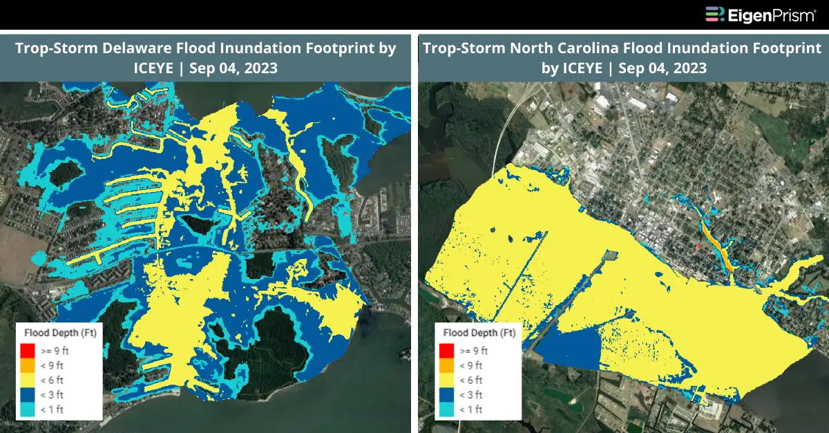
ICEYE: Latest flood inundation and flood extent footprints from ICEYE
‘Tropical Storm Ophelia Sep 2023 ICEYE Post-Event Impact Summary – Template‘
September 22, 2023 | Mid-Atlantic Braces for Tropical Storm with Potential to Intensify: Get Actionable Insights on EigenPrism
A tropical storm warning has been issued for portions of the North Carolina and mid-Atlantic coastlines due to an evolving storm system. This system is expected to move northward along the coast extending from Florida to New England during the weekend, bringing with it strong gusts, heavy rainfall, dangerous rip currents, and coastal flooding.
The area of low pressure, referred to as Potential Tropical Cyclone 16, is currently situated off the eastern coast of Florida with winds reaching 35 mph. It is projected to gain strength and develop into a tropical storm by Friday as it approaches the coast of North Carolina. Depending on the timing of its classification, it may be named either Ophelia or Philippe.
A tropical storm warning has been activated for the area spanning just south of Wilmington, North Carolina, to the Maryland-Delaware state line. It is possible that tropical storm-force winds could impact North Carolina as early as Friday, with further progression into the mid-Atlantic region expected on Saturday.
Actionable Insights on EigenPrism
All EigenPrism® users can assess the forecast using the following quick links:
- Hurricane-Force (>64 kt) Wind Probabilities for the 120 hours as of 2023-09-22
- Tropical-Storm-Force (>34 kt) Wind Probabilities for the 120 hours as of 2023-09-22
- Tropical Storm 16 Forecast Winds Swath – Advisory 04 as of 2023-09-22
Don’t have access to EigenPrism?
Sign up for a trial account and access complete impact reports of all events. Contact us and we’ll set up a trial account for you.