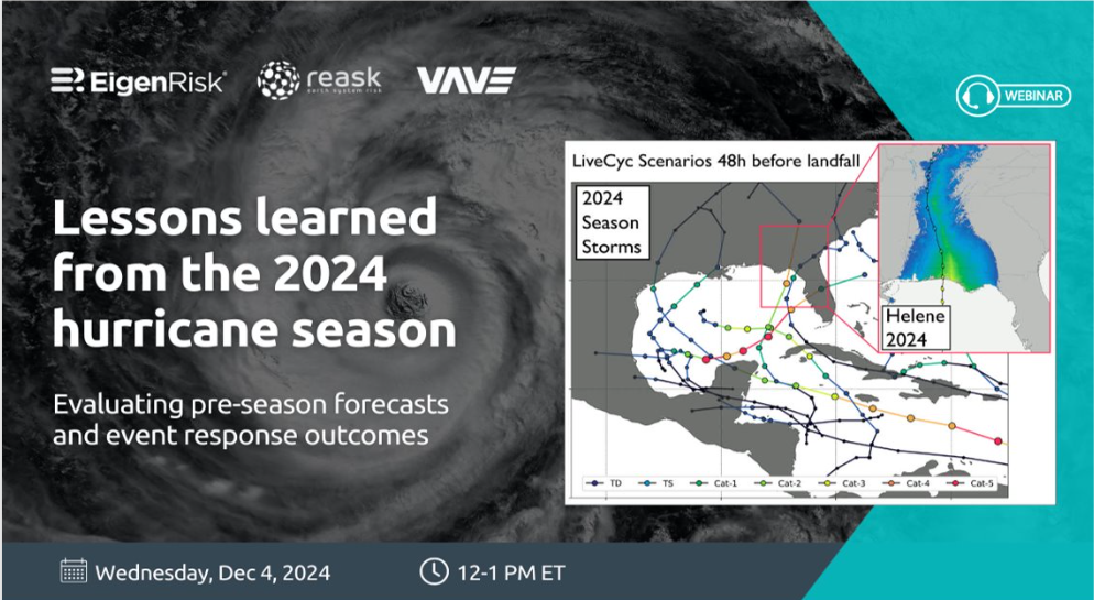
Lessons learned from the 2024 Hurricane Season
Evaluating pre-season forecasts and event response outcomes
In June 2024, when Hurricane Beryl became the earliest Category 5 storm to form in the Caribbean, it appeared early predictions of the 2024 Atlantic Hurricane season as “above active” were right on target.
A new EigenRisk webinar – featuring Reask Co-Founder Nico Bruneau and Louise Braybrooke, Chief Client Officer, as well as Tim Spencer, head of Portfolio Analytics, VAVE Insurance and Jon Sonnenschein, director of Business Development, EigenRisk – looked back on the 2024 Atlantic hurricane season and compared what occurred against what had been predicted.
They also demonstrated Reask LiveCyc’s newly enhanced capabilities available on the EigenRisk platform, which can help risk, insurance and recovery professionals prepare for and manage future storm-related exposures faster and more effectively.
Climate conditions right for active 2024 storm season
To begin the discussion, Bruneau reviewed the factors the led to the widespread early predictions for an “extremely active” 2024 hurricane season. He cited multiple climate drivers that would lead to the formation of more storms, including the shift to La Nina, a warm Atlantic, which favors cyclone development, an active West African monsoon and increase in frequency and intensity of tropical waves originating in Africa, a precursor to tropical storm formation.
Meanwhile, the presence of La Nina results in an absence of counter-balancing effects, such as wind shear. So, prior to the start of the 2024 Atlantic Hurricane season every trigger was in place to support a strong forecast.
Using robust analytics, Reask generates thousands of stochastic track sets driven by the season forecasted state of the climate. This enables carriers and other users to view the percentage difference of a hurricane occurrence for every pixel of the North American map compared with a long-term baseline, dating back decades from the 1990s to the present. At the start of the 2024 hurricane season, Reask’s maps showed the Gulf of Mexico to have greater hurricane risk than the Atlantic.
Bruneau explained that based on the early predictions, 2024 could have been a very severe year in terms of storm activity, damage and destruction. He then proceeded to compare those calculations to what occurred.
In fact, five hurricanes made landfall in the U.S. during 2024, which is considered a “strong” hurricane season; only five times in history (dating back to the 1990s) have five or more hurricanes made landfall in the U.S.
Furthermore, Bruneau explained that there have only been two years in recent history when two of more major hurricanes made landfall. In 2024, Hurricane Beryl became the earliest category 5 storm to form in the Gulf of Mexico. During the peak of the season, Hurricanes Helene and Milton made landfall back-to-back.
Given the number of major storms, Spencer said 2024 could have been an extreme year in terms of damage. However, he explained most of the storms making landfall literally “threaded a needle” between densely populated areas. Had the paths been slightly different, the wind-driven damage loss in 2024 might have been much worse. Milton tracked further south than projected as its wind speed decreased from category 5 to category 3. The deviation in projection to occurrence underscores the importance for carriers to be able to respond rapidly to these unfolding events.
Sonnenschein observed that although many seasonal hurricane records were broken in 2024, citing early occurrence of a major storm and the overall frequency, they were not the ones expected based on the projections.
Pointing to specific landfall points plotted on a map of the U.S. southeast, Bruneau showed that since 2017, the West Coast of Florida has been severely hit by multiple hurricanes.
Preparing for the worst
Sonnenschein and Bruneau proceeded to demonstrate how LiveCyc can be used on the EigenRisk platform to obtain detailed and timely projections of storm paths beginning three days prior to landfall. The model generates high-resolution footprints (1 kilometer) with thousands of stochastic tracks using the same algorithm.
Bruneau explained that further out on the timeline in advance of landfall, the cone of uncertainty can be quite wide.
Spencer explained how VAVE was able to use the projections on the EigenRisk platform in developing their response to Hurricanes Helene and Milton. In reflecting on the past season, he said that after a brief respite in 2023, the insurance industry experienced a larger number of storm-related losses in 2024.
Right data and tools keys to effective event preparation and response
Among the takeaways from the 2024 season, Sonnenschein emphasized the need to recognize that major storms can change intensity “on a dime” and turn direction quickly. Thus, carriers must be ready, understand their exposures and be able to stay on top of any developing event.
Drawing on VAVE’s experience, Spencer indicated it can be helpful for carriers to have their portfolios maintained and continually kept up to date in a versatile tool like EigenRisk. Notably, seamless access to providers such as Reask enables his team to track and assess the potential and actual impact on VAVE’s portfolios of hurricanes and other severe weather events as they are unfolding and in their immediate aftermath.
Want to learn more?
To access the webinar, click here. To learn more about Reask’s LiveCyc on the EigenRisk platform, please contact us: