Hurricane Kiko Weakens but Continues to Threaten Hawaii with Surf and Rain
Hurricane Kiko continues to weaken in the central Pacific but remains a hurricane as of late Sunday. Once a Category 3 storm, Kiko was downgraded to Category 2 on Sunday evening, with maximum sustained winds near 105 mph. As of the latest advisory from the National Hurricane Center (NHC), the system was located about 555 miles east of Hilo.
Forecasters expect Kiko to weaken into a tropical storm by Tuesday gradually. However, the system will still carry the potential to bring heavy rain, gusty winds, and life-threatening surf to Hawaii. The storm is expected to pass north of the islands on Tuesday and Wednesday, and the likelihood of a direct landfall remains very low.
Rainfall of 1 to 2 inches is expected across most of the Hawaiian Islands from Tuesday through Wednesday as Kiko passes, with wind gusts exceeding 40 mph possible along northern areas, mainly within squalls forming on the storm’s outer edges.
Actionable Analytics on EigenPrism
Windstorm Datasets
Forecast
All EigenPrism® users can assess the forecast of the tropical cyclone using the following report template:
This report template consists of the following wind and flood footprints: Wind arrival times from NOAA, 5-day forecast max winds from Adiabat, Wind swath forecast advisory & Wind probabilities (34 & 64 kt) by Hurricane Mapping. The pages auto-update with the latest available data.
Reask
Subscribers of Reask can use these real-time footprints on EigenPrism® to quickly assess the wind impact:
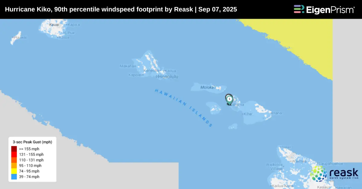
- Hurricane KIKO 90th percentile windspeed footprint from Reask LiveCyc as of Sep 07, 2025
- Hurricane KIKO 50th percentile windspeed footprint from Reask LiveCyc as of Sep 07, 2025
Reask’s LiveCyc Scenarios
Reask subscribers in EigenPrism can use the LiveCyc ensemble scenarios for Hurricane Kiko to generate a range of potential loss estimates with more confidence.
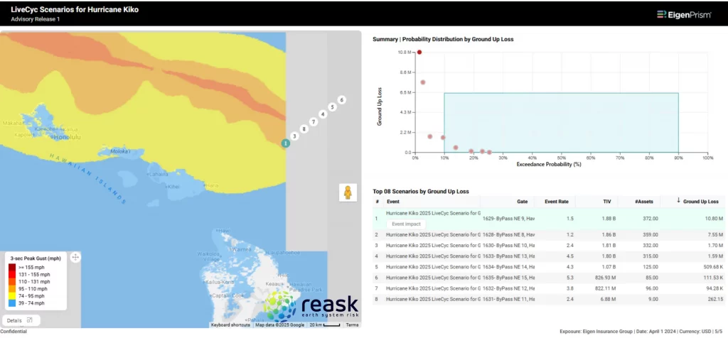
To view multiple scenarios at once, you can run Eigen Rover – Here’s how:
- Start an EigenRover Analysis and select your exposure dataset.
- When the Model Catalog opens automatically, open the event set ‘Tropical Cyclone Forecast: Windspeed Footprint Ensembles from Reask LiveCyc’, type in ‘Kiko’ in the search box, and choose the footprints for the latest release.
- Click ‘Run’ to generate loss estimates based on the different ensemble scenarios. For more information on the scenarios, you can add additional columns like the event rate and gate to the table by clicking on the ellipsis of the table and choosing the fields.
Post-Event
All EigenPrism® users can assess the impact of the tropical cyclone using the following report template:
The report template consists of the following wind footprints: Past max winds by Adiabat and Past wind swath by Hurricane Mapping. The pages auto-update with the latest available data.
Alerts
Users who have alerts set on their exposures for the relevant event sets, like those from NOAA, Adiabat & Hurricane Mapping, will receive alerts (if the event footprints impact these exposures).
To learn more about how to set an alert on a specific event set, check out this help center article.
Feel free to contact us at Prism.Support@eigenrisk.com or reach out directly to your Customer Success Manager with any questions or concerns. Our team is here to assist you with setting alerts, understanding report templates, and maximizing the actionable insights available through EigenPrism®.
Download the EigenAlert Mobile App Today!
With the EigenAlert mobile app, monitor alerts and impacted assets without being tied to your desk.
How to Get Started:
- Scan the QR code using your phone to download the app.
- Log in with your existing EigenPrism credentials.
- Begin accessing your alerts instantly.