Flooding concerns in California as Hurricane Kay passes along the Western coast
On Thursday afternoon, Hurricane Kay made landfall in Mexico along the west coast of the central Baja California Peninsula, raising fears about flooding not just there but also in other areas of California and Arizona.
Kay was a Category 1 hurricane when it landed, with top sustained winds of 75 mph. It’s anticipated to deteriorate all through Thursday night. On Tuesday, it strengthened to a Category 2 storm and was anticipated to grow more and become a Category 3 storm.
Through Friday, Kay is predicted to follow a course parallel to the Baja California peninsula, sending potentially record-breaking amounts of rain into Southern California and Arizona. Areas of southwest Arizona might see flooding as well.
It will likely retain hurricane strength until it is around 250 miles near San Diego.
Assessing the Impact
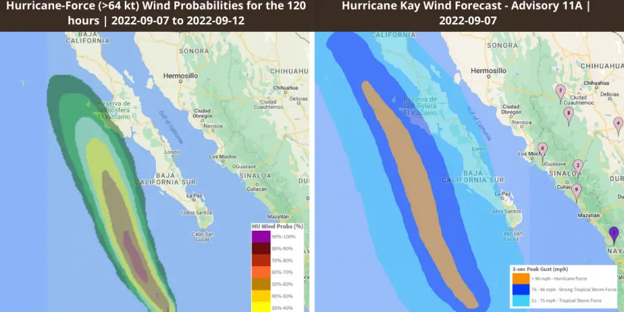
EigenPrism® users can access the following quick links to track Hurricane Kay. You can immediately overlay the following footprints on your exposure:
-
TropStorm Kay Forecast Wind Swath – Advisory 21A – as of 2022-09-09
- Hurricane Kay 2022 5-day Forecast Max Winds at 2022-09-09
-
Hurricane-Force (>64 kt) Wind Probabilities for the 120 hours from 2022-09-08 to 2022-09-13
- Hurricane-Force (>34 kt) Wind Probabilities for the 120 hours from 2022-09-09 to 2022-09-14