Texas Braces for Potential Floods as Spring Rains Drench the South: Actionable Insights on EigenPrism
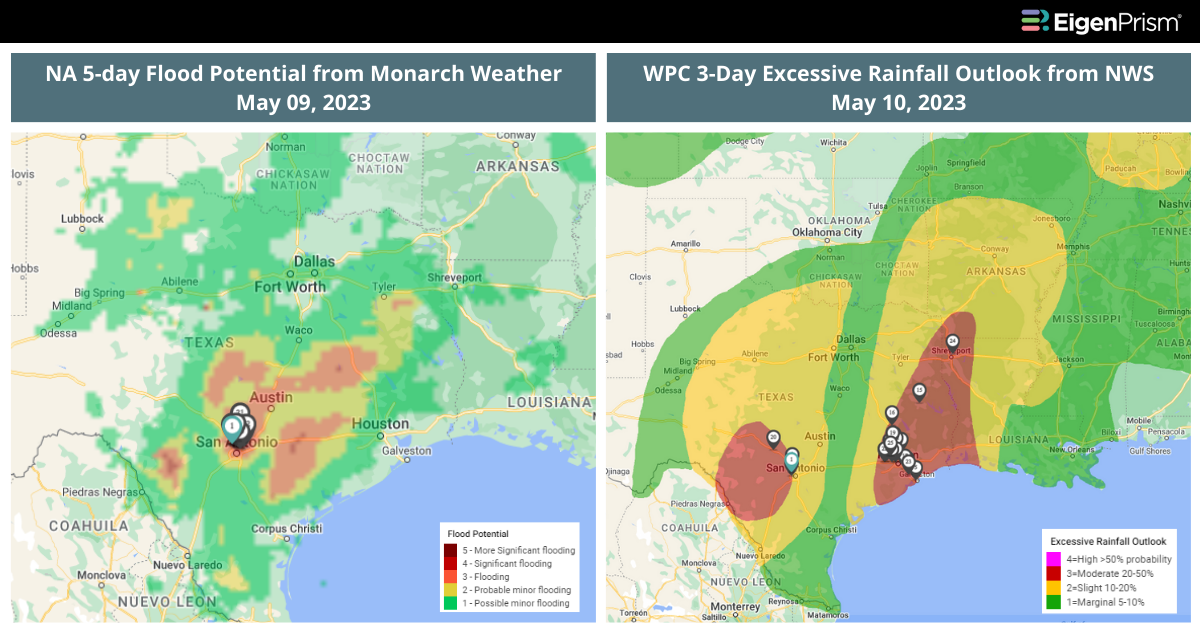
Heavy rainfall is expected to occur in the United States Southern region this week, posing a potential risk of flash flooding for millions of people. The southeastern Texas area, including the Houston metro region, could experience flash flooding from the middle and upper Texas Gulf Coast to inland areas across the southeast Texas Triangle.
The prediction center has issued a Level 3 out of 4 risk for excessive rainfall on Tuesday and Wednesday, which could result in as much as 3 to 7 inches of rainfall with some areas receiving up to 10 inches.
Over 7 million people in southeastern Texas are under flash flood watches through Wednesday evening. The broader region of southeast Texas and southwest Louisiana is also at risk, including Lake Charles, College Station, and Victoria, which have a Level 2 risk. On Wednesday, the Level 2 risk will extend to other areas, such as Dallas, Shreveport, and Little Rock, which could receive around 2 inches of heavy rainfall.
Actionable Insights on EigenPrism
To make timely decisions about this event, EigenPrism® users can assess the impact of the event using the following quick links:
- NA 5-day Flood Potential as of 2023/05/09 – v3 | v4
- WPC 3-Day Excessive Rainfall Outlook valid from 2023-05-10 1200 UTC to 2023-05-13 – v3 | v4
Don’t have access to EigenPrism?
Sign up for a trial account and access full impact reports of all events. Contact us and we’ll set up a trial account for you.