Eastern US Braces for Wide-Reaching Storm, Rain, Snow, and Strong Winds Expected
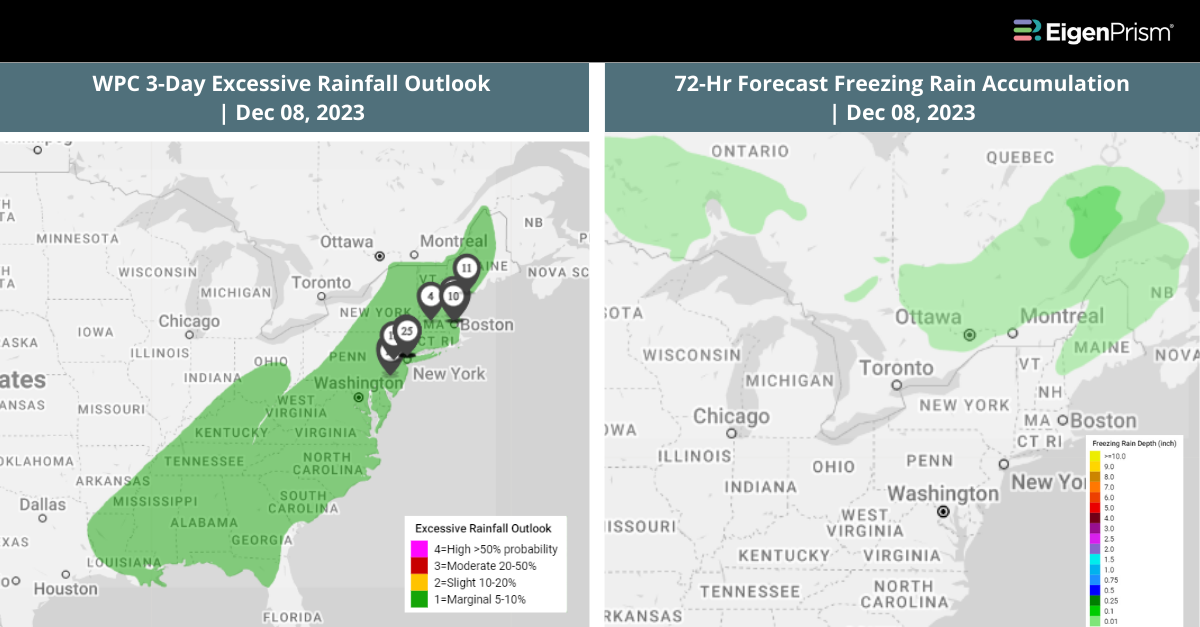
A significant storm is poised to impact the eastern half of the United States this weekend, bringing a mix of heavy rain, severe thunderstorms, strong winds, and snow. Originating in the southern Plains on Friday, the storm will intensify and spread across the Midwest, reaching 1,200 miles from the Gulf Coast to the Canadian border by Saturday.
Severe thunderstorms are likely, especially in Oklahoma, Arkansas, Texas, and parts of the South, with the potential for damaging winds and hail. The storm will also spread rain across the Midwest and South, with steady, heavy downpours expected. Accompanying gusty winds may cause power outages and disrupt travel.
A thin stripe of snow is possible in areas from Wisconsin to Michigan’s Upper Peninsula. By Sunday, the storm will reach its peak strength, affecting much of the East with stronger wind gusts, potentially causing further disruptions.
Rain will be the primary form of precipitation, with 1 to 2 inches expected widely and higher totals in areas with multiple downpours. The storm will move off the East Coast by Monday, but rain and snow will continue in New England and upstate New York, followed by a drop in temperatures across the eastern US.
Eastern US Braces for Wide-Reaching Storm: Actionable Insights On Eigenprism
All EigenPrism® users can assess the forecast using the following quick links:
- 72-Hr Forecast Freezing Rain Accumulation (90th Percentile) as of 2023-12-08
- 72-Hr Forecast Snow Accumulation (90th Percentile) as of 2023-12-08
- WPC 3-Day Excessive Rainfall Outlook valid from 2023-12-08
- 1-3 Day Potential Winter Storm Overall Impact as of 2023-12-08
- 5-day Flood Potential as of 2023-12-08
- Daily Peak Wind Gust across as of 2023-12-07
Don’t have access to EigenPrism®?
Sign up for a trial account and access full impact reports of all events. Contact us and we’ll set up a trial account for you.