Continued Severe Weather Threat in Eastern US Following Tornadoes in Tennessee
After a weekend of severe weather, including deadly tornadoes in Tennessee, the eastern US braces for more adverse conditions into Monday. A massive storm, having already unleashed severe thunderstorms, heavy rainfall, and intense winds across at least a dozen eastern states on Sunday, continues to pose significant threats.
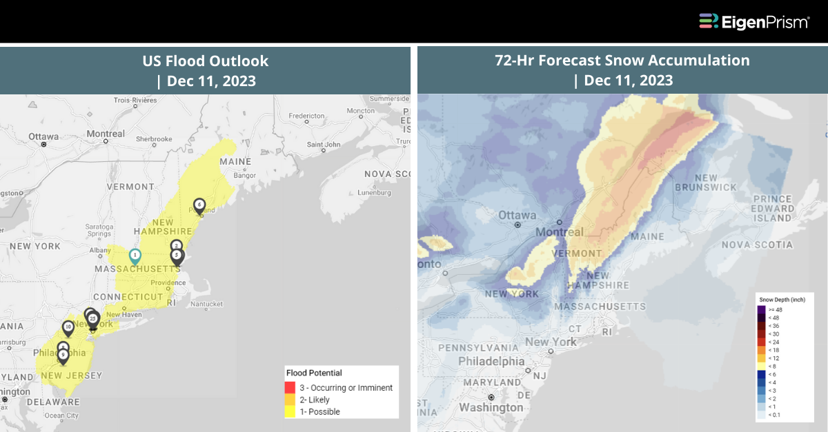
The storm, reaching its peak strength on Sunday, has stretched from the Southeast to the Northeast, bringing a significant flood risk, particularly in New England. The Storm Prediction Center has issued a Level 2 of 5 risk for severe thunderstorms for parts of the eastern Carolinas and southeast Virginia, with potential for damaging wind gusts and tornadoes.
Monday’s forecast for New England predicts continued heavy rainfall, with two-day totals potentially exceeding 4 inches. Some isolated locations might even see up to half a foot of rain by the storm’s end. Gusty winds accompanying the heavy rainfall will increase the danger.
Widespread gusts of 40 to 50 mph will sweep across the mid-Atlantic and Northeast, particularly within about 150 miles of the coast. In addition to the rain and wind, snow will fall on Sunday night. The transition from rain to wet snow is forecasted across portions of the interior Northeast and will continue through Monday.
Snow will reach Maine on Monday and continue to fall across Vermont and New Hampshire. Winter storm warnings are in effect for parts of New York, Vermont, Pennsylvania, and New Hampshire. This ongoing severe weather event highlights the need for continued vigilance and preparedness across the affected regions.
Severe Weather Threat in Eastern US Following Tornadoes: Actionable Insights on EigenPrism
All EigenPrism® users can assess the forecast using the following quick links:
- 72-Hr Forecast Freezing Rain Accumulation (90th Percentile) as of 2023-12-11
- 72-Hr Forecast Snow Accumulation (90th Percentile) as of 2023-12-11
- US Flood Outlook as of 2023-12-11
- 1-3 Day Potential Winter Storm Overall Impact as of 2023-12-11
- WPC 3-Day Excessive Rainfall Outlook valid from 2023-12-10
Don’t have access to EigenPrism®?
Sign up for a trial account and access full impact reports of all events. Contact us and we’ll set up a trial account for you.