California’s Coast Braces for Intense Storm Challenges
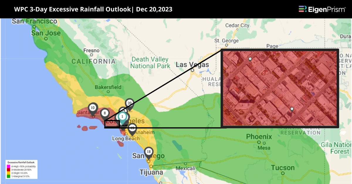
A formidable storm system is sweeping across California, bringing the threat of heavy rains, potential flooding, and the ever-looming danger of mudslides. Forecasts predict a torrential downpour, especially from Los Angeles to Santa Barbara. These natural events are especially perilous in California due to its unique topography and urban settings. The risk is heightened in low-lying areas, where road flooding is highly likely.
Coastal areas will receive 2 to 4 inches of rain, while mountain regions could see 4 to 8 inches. Los Angeles might experience more than a month’s worth of rain in just a few days. The storm will also bring significant snow to the Sierra Nevada, with the highest peaks expecting 6 to 12 additional inches. By Friday, the system will push moisture east into Arizona, Utah, and Nevada, accompanied by 20-30 mph winds, leading to hazardous travel conditions for the holiday weekend.
California’s Coastal Bracing for Intense Storms Challenges: Actionable Insights on EigenPrism
All EigenPrism® users can assess the forecast using the following event footprints:
- 72-Hr Forecast Snow Accumulation (90th Percentile) as of 2023-12-21
- WPC 3-Day Excessive Rainfall Outlook as of 2023-12-20
- NA 5-day Flood Potential as of 2023-12-20
- Landslide Potential as of 2023-12-20
Don’t have access to EigenPrism®?
Sign up for a trial account and access full impact reports of all events. Contact us and we’ll set up a trial account for you.