Beryl Leaves Severe Devastation and Millions of Texans Without Power
Beryl struck southern Texas as a Category 1 hurricane on Monday, causing power outages for over 2.5 million homes and resulting in at least 8 fatalities in Texas and Louisiana. The storm left a trail of devastation, with cars submerged, roofs torn off, roads washed out, and emergency services working tirelessly to rescue those affected.
As Beryl moves inland, it will bring heavy rainfall and tornado threats to the Midwest and Northeast throughout the week. Currently classified as a tropical depression centered in Arkansas, Beryl is expected to merge with a frontal system later today, transitioning into a post-tropical cyclone. Rainfall from Beryl will reach Washington, D.C., by Wednesday evening and continue into Philadelphia and New York City overnight into Thursday morning.
The National Hurricane Center has issued a warning for continued flooding rains and the risk of tornadoes across parts of eastern Texas, western Louisiana, and Arkansas.
Beryl Leaves Severe Devastation in Texas: Actionable Insights on EigenPrism
Post-event
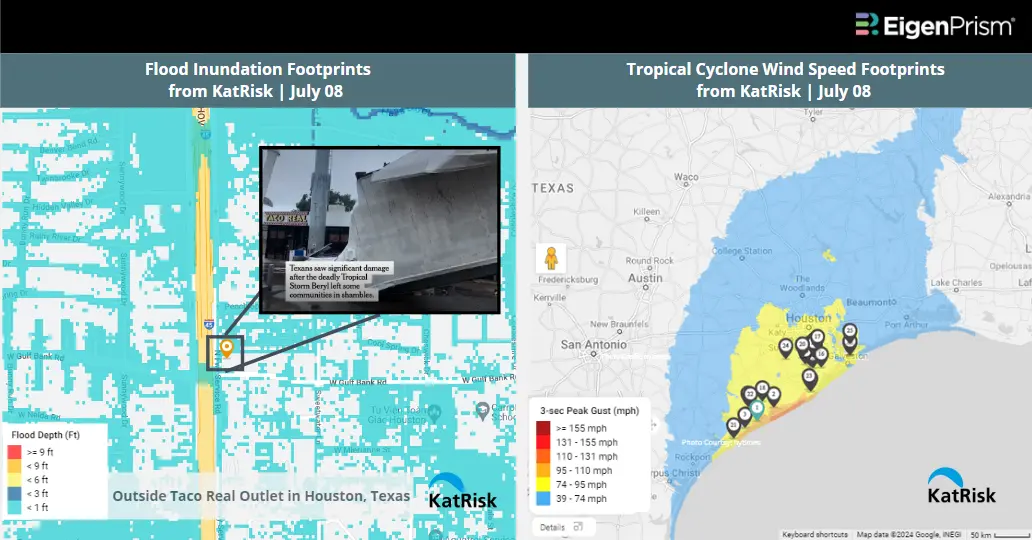
Subscribers of KatRisk can use these real-time footprints on EigenPrism® to quickly assess the impact :
Hurricane Beryl Flood Inundation Footprints from KatRisk as of July 08
Beryl wind speed footprints from KatRisk as of Jul 08
Subscribers of Reask can use this real-time footprint on EigenPrism® to quickly assess the impact of flooding:
Tropical Cyclone wind speed footprints from Reask LiveCyc as on July 08
All EigenPrism® users can assess the post-event of the tropical cyclone using the following report template.
Hurricane Beryl 2024 Post-Event Impact Report
The report template auto-updates with the latest available footprints, which include:
- Hurricane Beryl 2024 Past Max Winds by Adiabat
- Hurricane Beryl Past Wind Swath – Advisory by Hurricane Mapping
Forecast
All EigenPrism® users can assess the forecast of the tropical cyclone using the following report template.
Tropical Cyclone Forecast Impact Report (2024)
The report template auto-updates with the latest available footprints, which include:
- Tropical-Storm-Force (greater than 34 kt) Wind Arrival Times by NOAA
- Tropical Cyclone Forecast: Wind Swaths by Hurricane Mapping
- Tropical Cyclone Forecast: Maximum Winds by Adiabat
- 5-day Tropical-Storm-Force (greater than 34 kt) Wind Probabilities by Hurricane Mapping
- 5-day Hurricane-Force (greater than 64 kt) Wind Probabilities by Wind Hurricane Mapping
- 3-Day Excessive Rainfall Outlook by NWS
- 5-day Flood Potential by Adiabat
- 3-day Flood Potential by Adiabat
- Tropical Cyclone Forecast: Storm Surge Flooding Potential by NOAA
_____________________________________
Beryl Makes landfall in Texas as Category 1 Hurricane : Brings Damaging Winds and Storm Surge – July 08
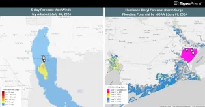
Hurricane Beryl, after causing severe damage in Jamaica and Cayman Islands, it lashed Mexico’s Yucatán Peninsula wreaking havoc across the Caribbean on Friday. On Monday, Beryl has made landfall on the middle Texas coast near Matagorda, bringing maximum sustained winds of 80 mph, classifying it as a Category 1 storm and hasn’t weakened after making landfall. The storm is currently about 85 miles south-southwest of Houston.
The National Hurricane Center has issued a hurricane warning for parts of the Texas coast, where Beryl is expected to bring damaging winds, storm surge, heavy rainfall, and tornadoes. Beryl is bringing “extreme rainfall rates” and “life-threatening” floods to areas in Texas over next few hours. Widespread flash flooding is anticipated, with severe urban flash flooding posing life-threatening risks. Major metropolitan areas, particularly around Houston and Galveston, are at high risk over the next several hours.
Rainfall rates could reach two to four inches per hour, especially where the inner eyewall or organized bands east of the storm’s center pass through. Total rainfall amounts of four to eight inches are expected by midday.
Hurricane Beryl Makes landfall in Texas: Actionable Insights on EigenPrism
Post-event
Subscribers of KatRisk can use this real-time footprint on EigenPrism® to quickly assess the impact :
Beryl wind speed footprints from KatRisk as of Jul 06
Subscribers of Reask can use this real-time footprint on EigenPrism® to quickly assess the impact of flooding:
Tropical Cyclone wind speed footprints from Reask LiveCyc as on July 08
All EigenPrism® users can assess the post-event of the tropical cyclone using the following report template.
Hurricane Beryl 2024 Post-Event Impact Report
The report template auto-updates with the latest available footprints, which include:
- Hurricane Beryl 2024 Past Max Winds by Adiabat
- Hurricane Beryl Past Wind Swath – Advisory by Hurricane Mapping
Forecast
All EigenPrism® users can assess the forecast of the tropical cyclone using the following report template.
Tropical Cyclone Forecast Impact Report (2024)
The report template auto-updates with the latest available footprints, which include:
- Tropical-Storm-Force (greater than 34 kt) Wind Arrival Times by NOAA
- Tropical Cyclone Forecast: Wind Swaths by Hurricane Mapping
- Tropical Cyclone Forecast: Maximum Winds by Adiabat
- 5-day Tropical-Storm-Force (greater than 34 kt) Wind Probabilities by Hurricane Mapping
- 5-day Hurricane-Force (greater than 64 kt) Wind Probabilities by Wind Hurricane Mapping
- 3-Day Excessive Rainfall Outlook by NWS
- 5-day Flood Potential by Adiabat
- 3-day Flood Potential by Adiabat
- Tropical Cyclone Forecast: Storm Surge Flooding Potential by NOAA
_____________________________________
Jamaica Braces For Hurricane Beryl As Category 4 Storm Leaves Grenada Battered – July 03
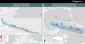
Jamaica is on high alert as Hurricane Beryl, a Category 5 storm, is rapidly advancing toward Jamaica. With sustained winds reaching 165 mph, the hurricane poses a significant threat to the Island. According to the National Hurricane Center, it is the strongest July hurricane ever recorded, beating Emily in 2015. The National Hurricane Center expects Beryl to remain an “extremely dangerous” Category 5 storm as it approaches Jamaica on Wednesday and the Cayman Islands on Thursday.
Officials predict that Beryl will make landfall within the next 24 hours, bringing with it life-threatening storm surges and torrential rainfall. Authorities have issued a hurricane warning and imposed an island-wide curfew to keep people safe during the storm’s peak.
Beryl, will then go on to hammer the Cayman Islands and the Yucatan Peninsula before facing an uncertain future in the Gulf of Mexico that could include impacts in eastern Mexico and Texas.
The Category 4 storm left Grenada with an “unimaginable destruction”. Officials said about 98 per cent of the buildings on the islands, home to 6,000 people, had been damaged or destroyed.
Jamaica Braces For Hurricane Beryl: Actionable Insights on EigenPrism
Post-event
All EigenPrism® users can assess the post-event of the tropical cyclone using the following report template.
Hurricane Beryl 2024 Post-Event Impact Report
The report template auto-updates with the latest available footprints, which include:
- Hurricane Beryl 2024 Past Max Winds by Adiabat
- Hurricane Beryl Past Wind Swath – Advisory by Hurricane Mapping
Forecast
All EigenPrism® users can assess the forecast of the tropical cyclone using the following report template.
Tropical Cyclone Forecast Impact Report (2024)
The report template auto-updates with the latest available footprints, which include:
- Tropical-Storm-Force (greater than 34 kt) Wind Arrival Times by NOAA
- Tropical Cyclone Forecast: Wind Swaths by Hurricane Mapping
- Tropical Cyclone Forecast: Maximum Winds by Adiabat
- 5-day Tropical-Storm-Force (greater than 34 kt) Wind Probabilities by Hurricane Mapping
- 5-day Hurricane-Force (greater than 64 kt) Wind Probabilities by Wind Hurricane Mapping
- 3-Day Excessive Rainfall Outlook by NWS
- 5-day Flood Potential by Adiabat
- 3-day Flood Potential by Adiabat
_____________________________________
Hurricane Beryl Intensifies to Category 5 Strength After Lashing Caribbean Islands – July 02
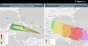
Hurricane Beryl, a historic and devastating storm, has rapidly intensified into a dangerous Category 5 hurricane, as it powers across the Caribbean after bringing devastation to the Windward Islands marking the earliest such storm on record in the Atlantic. Beryl’s rapid strengthening from a tropical depression to a major hurricane in just 48 hours, is highly unusual for this time of year.
It made landfall on Monday on the Caribbean Island of Carriacou in Grenada as a powerful Category 4 storm. With devastating winds reaching up to 150 mph (240 kph), the storm caused extensive damage, blowing off roofs, uprooting trees, and leading to widespread power outages.
Fuelled by record-high ocean temperatures, Beryl is expected to bring life-threatening winds, storm surge, and heavy rainfall to the southeastern Caribbean. Forecasters have warned of a potential storm surge of up to 9 feet and rainfall of up to 10 inches in some areas.
The U.S. National Hurricane Center described Beryl as “extremely dangerous and life-threatening”. The storm’s rapid intensification is a concerning sign for the 2024 hurricane season, which experts predict will be above-average in activity.
Hurricane Beryl Intensifies to Category 5: Actionable Insights on EigenPrism
Post-event
All EigenPrism® users can assess the post-event of the tropical cyclone using the following report template.
Hurricane Beryl 2024 Post-Event Impact Report
The report template auto-updates with the latest available footprints, which include:
- Hurricane Beryl 2024 Past Max Winds by Adiabat
- Hurricane Beryl Past Wind Swath – Advisory by Hurricane Mapping
Forecast
All EigenPrism® users can assess the forecast of the tropical cyclone using the following report template.
Tropical Cyclone Forecast Impact Report (2024)
The report template auto-updates with the latest available footprints, which include:
- Tropical-Storm-Force (greater than 34 kt) Wind Arrival Times by NOAA
- Tropical Cyclone Forecast: Wind Swaths by Hurricane Mapping
- Tropical Cyclone Forecast: Maximum Winds by Adiabat
- 5-day Tropical-Storm-Force (greater than 34 kt) Wind Probabilities by Hurricane Mapping
- 5-day Hurricane-Force (greater than 64 kt) Wind Probabilities by Wind Hurricane Mapping
- 3-Day Excessive Rainfall Outlook by NWS
- 5-day Flood Potential by Adiabat
- 3-day Flood Potential by Adiabat
_____________________________________
Beryl, the First Atlantic Hurricane of 2024, Approaches Barbados and Windward Islands – June 30
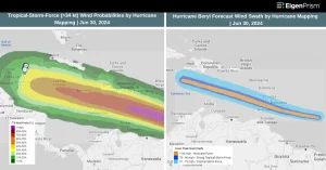
Beryl, the first hurricane of the 2024 Atlantic season, has rapidly intensified as it approaches Barbados and the Windward Islands. The National Hurricane Center warns of destructive hurricane-force winds and life-threatening storm surges.
As of Saturday evening, Beryl was located about 595 miles east-southeast of Barbados, with maximum sustained winds near 85 mph. It moved west at around 20 mph. The hurricane strengthened significantly overnight, with its winds increasing from 35 mph to 75 mph in less than 24 hours, meeting the definition of rapid intensification. Beryl is now on track to become a major hurricane as it approaches the Windward Islands.
. Beryl brings the risk of heavy rainfall, destructive winds, and dangerous storm surges and waves. Expected rainfall ranges from 3 to 6 inches across Barbados and the Windward Islands from Sunday into Monday, which may cause flooding. Southeastern Puerto Rico could see 1 to 4 inches of rain from Monday night into Tuesday.
In Saint Vincent and the Grenadines, the storm could reach the islands by Monday morning as a Category 2 hurricane. The meteorological service predicts sustained winds of 74 to 110 mph (119 to 177 km/h) and rainfall amounts of 4 to 6 inches. In Saint Lucia, the government warns that the storm could bring “moderate to heavy showers, thunderstorms, and gusty winds” to the region.
Beryl, The First Atlantic Hurricane of 2024: Actionable Insights on EigenPrism
All EigenPrism® users can assess the forecast of the tropical cyclone using the following report template.
Tropical Cyclone Forecast Impact Report (2024)
The report template auto-updates with the latest available footprints, which include:
- Tropical-Storm-Force (greater than 34 kt) Wind Arrival Times by NOAA
- Tropical Cyclone Forecast: Wind Swaths by Hurricane Mapping
- Tropical Cyclone Forecast: Maximum Winds by Adiabat
- 5-day Tropical-Storm-Force (greater than 34 kt) Wind Probabilities by Hurricane Mapping
- 5-day Hurricane-Force (greater than 64 kt) Wind Probabilities by Wind Hurricane Mapping
- 3-Day Excessive Rainfall Outlook by NWS
- 5-day Flood Potential by Adiabat
- 3-day Flood Potential by Adiabat
Escape the News Cycle | Get Alerts Automatically For Events Impacting Your Assets
With EigenPrism Alerts, you can set Alerts and free yourself from constant event monitoring. Set up personalized alerts based on predefined impact thresholds and choose how you receive them – via email, SMS, or directly within EigenPrism. This way, you stay informed on your own terms, focusing only on the events that truly matter to your assets.
Set your alerts now.
Don’t have access to EigenPrism®?
Sign up for a trial account and access full impact reports of all events. Contact us, and we’ll set up a trial account for you.