Intense Flash Flooding in Alabama Cause Damage to Property
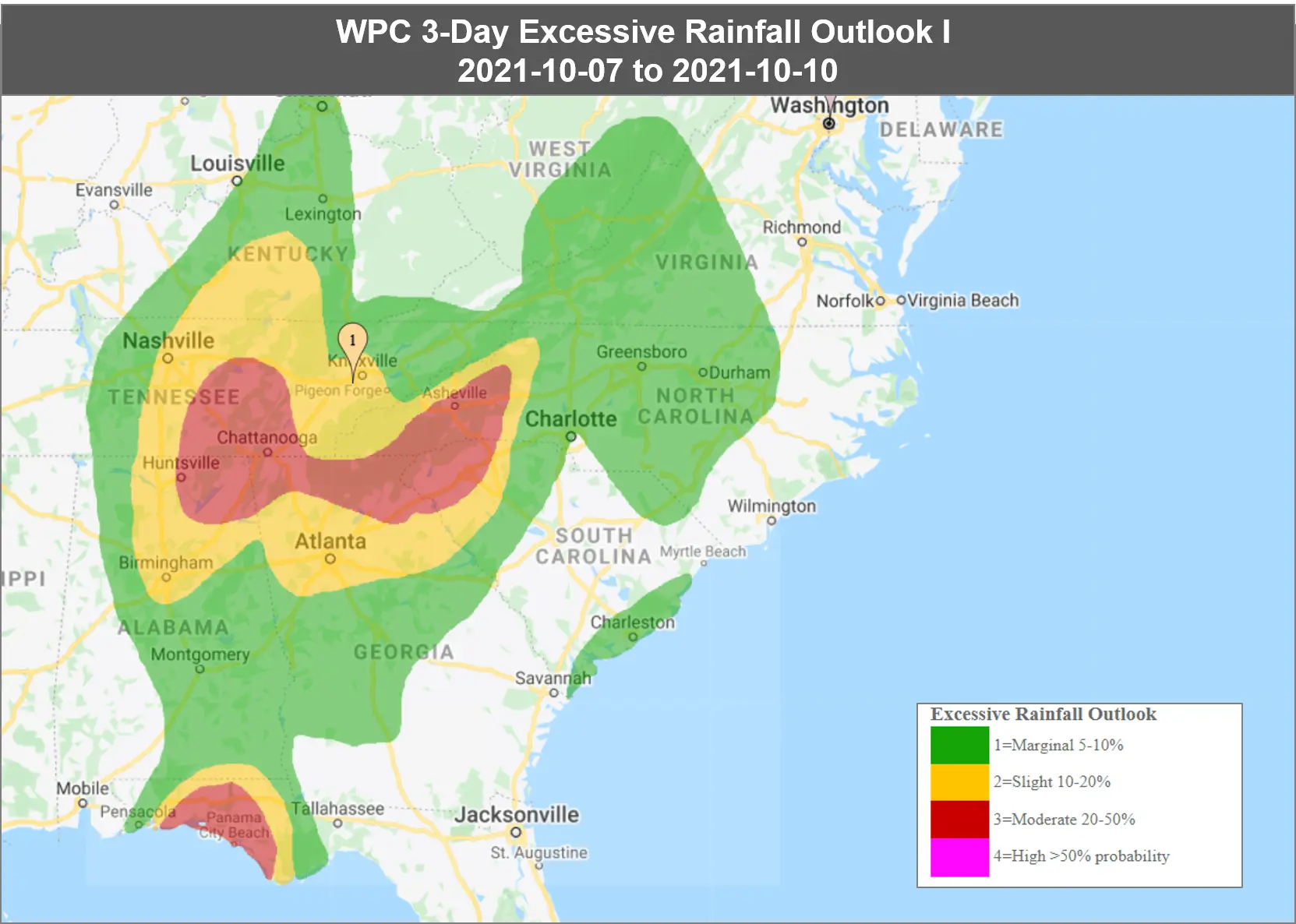
According to the National Weather Service, torrential rain sparked intense flooding in northern Alabama on Wednesday. Heavy rains rose water levels in low-lying areas across the region – submerging roads and houses in metro Birmingham and parts of Tennessee Valley.
As per the reports, around 6 inches of rainfall was recorded in a day as the low-pressure system lingered over Alabama and Florida Panhandle.
Flash flood warnings and watches are in effect across the southeastern US including parts of metro Birmingham – where heavy rainfall is most expected.
There is still a threat of few isolated tornadoes from the slow-moving low-pressure system. The National Weather Service has also issued a tornado watch for parts of northeastern Alabama, southern Tennessee and northwestern Georgia.
The rainfall is predicted to stop by late Thursday as the storms move eastward. However, the impact of flooding will be felt over the next few days.
Assessing the impact
EigenPrism users can access the following quick link to immediately overlay the event footprint on their exposure:
- WPC 3-Day Excessive Rainfall Outlook – from 2021-10-07 to 2021-10-10
Don’t have access to EigenPrism?
Sign up for a trial account and access full impact reports of all events. Contact us and we’ll set up a trial account for you.