Severe Flooding Causes Rivers to Rise Across Upper Midwest
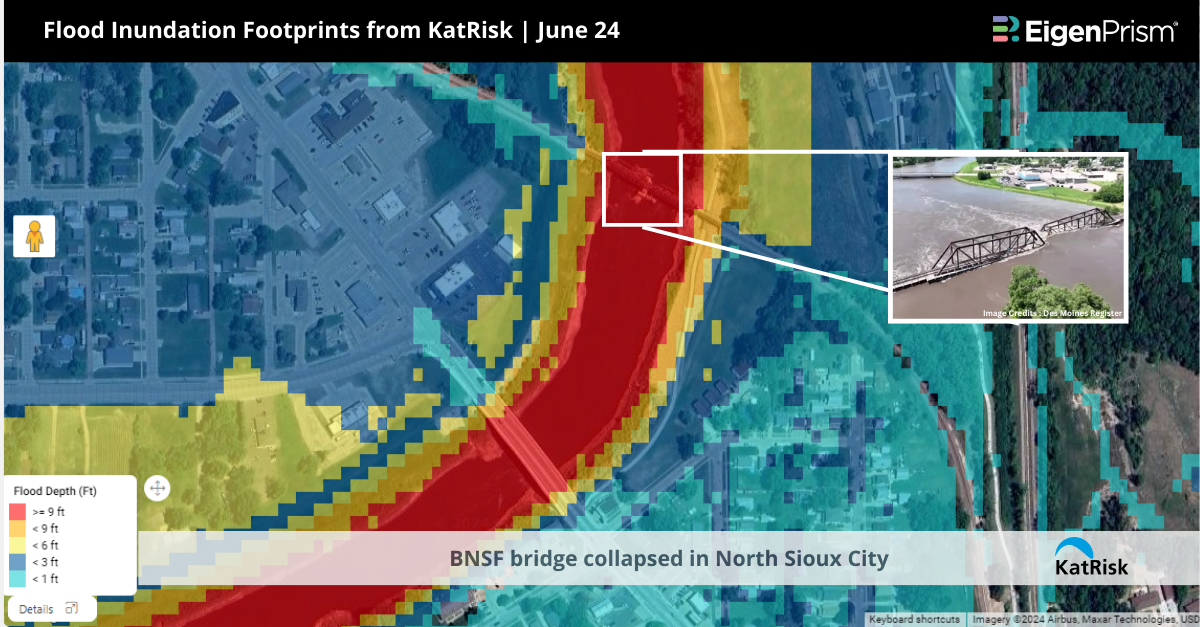
The Upper Midwest region, particularly Iowa and South Dakota, is currently experiencing catastrophic flooding due to record-breaking rainfall. Flood warnings remain in effect across multiple states, with Iowa and South Dakota being the most severely impacted. A railroad bridge between South Dakota and Iowa has collapsed due to severe flooding.
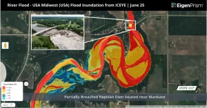
In Minnesota, the Rapidan Dam is on the brink of collapse following severe flooding and rainfall. The structure, located near Mankato, a city of approximately 45,000 residents, is in an “immediate failure condition.” The Blue Earth County government has reported a “partial failure on the west abutment” of the dam.
In Iowa, over 4,000 residents were forced to evacuate in Rock Valley as the Rock River reached unprecedented levels, leaving the region without clean water due to well contamination. Flood warnings continue for the Little Sioux River at Spencer, above Spencer/Highway 18, and near Milford, affecting Clay and Dickinson counties. The Cedar River at Cedar Rapids is also under a flood warning.
Other states under flood warnings include Nebraska, Minnesota, Wisconsin, and parts of Illinois. The National Weather Service has issued bulletins indicating that while some flood warnings are set to conclude late on Sunday, others will remain in effect until further notice.
Severe Flooding Across the Upper Midwest: Actionable Insights on EigenPrism
Post-event:
Subscribers of ICEYE can use this real-time footprint on EigenPrism® to quickly assess the impact of flooding:
River Flood – USA Midwest (USA) Midwest 2024 – Flood Inundation as of Jun 25
Subscribers of KatRisk can use this real-time footprint on EigenPrism® to quickly assess the impact of flooding:
Flood inundation footprints from KatRisk as of June 24
Forecast
All EigenPrism® users can assess the forecast of this event using the following report template:
US Flood Forecast Report Template
The report template auto-updates with the latest available footprints, which include:
- WPC 3-Day Excessive Rainfall Outlook from NWS,
- US Flood Outlook from NWS,
- NA 3-day Flood Potential from Adiabat, and
- NA 5-day Flood Potential from Adiabat
______________________________________
Catastrophic Flash Flooding Across The Upper Midwest – June 23
Severe weather has unleashed “catastrophic” flash flooding across the Upper Midwest, leading to widespread evacuations. More than a million people were under flood warnings in the upper US Midwest on Sunday after days of heavy rain that forced evacuations and rescues in several states. The hardest hit have been Iowa and South Dakota, where some rivers reached record-high levels.
States like Iowa, Minnesota, and South Dakota are particularly hard-hit, with some rivers poised to reach record-high levels. In Iowa, the Governor has issued a disaster proclamation for 21 counties, mobilizing state resources to aid affected communities. The city of Rock Valley, Iowa, saw all homes north of Highway 18 evacuated due to rising floodwaters. The flooding has caused significant damage, with entire communities submerged and numerous road closures.
Meanwhile, an Intense heatwave grips the US, triggering record-breaking temperatures. More than 100 million people across the US are currently under active National Weather Service (NWS) extreme heat alerts, according to the National Integrated Heat Health Information System on Saturday.
Catastrophic Flash Flooding Across the Upper Midwest: Actionable Insights on EigenPrism
Post-event:
Subscribers of ICEYE can use this real-time footprint on EigenPrism® to quickly assess the impact of flooding:
River Flood – USA Midwest (USA) Midwest 2024 – Flood Inundation as of Jun 24
Forecast
All EigenPrism® users can assess the forecast of this event using the following report template:
US Flood Forecast Report Template
The report template auto-updates with the latest available footprints, which include:
- WPC 3-Day Excessive Rainfall Outlook from NWS,
- US Flood Outlook from NWS,
- NA 3-day Flood Potential from Adiabat, and
- NA 5-day Flood Potential from Adiabat
Escape the News Cycle | Get Alerts Automatically For Events Impacting Your Assets
With EigenPrism Alerts, you can set Alerts and free yourself from constant event monitoring. Set up personalized alerts based on predefined impact thresholds and choose how you receive them – via email, SMS, or directly within EigenPrism. This way, you stay informed on your own terms, focusing only on the events that truly matter to your assets.
Set your alerts now.
Don’t have access to EigenPrism®?
Sign up for a trial account and access full impact reports of all events. Contact us, and we’ll set up a trial account for you.