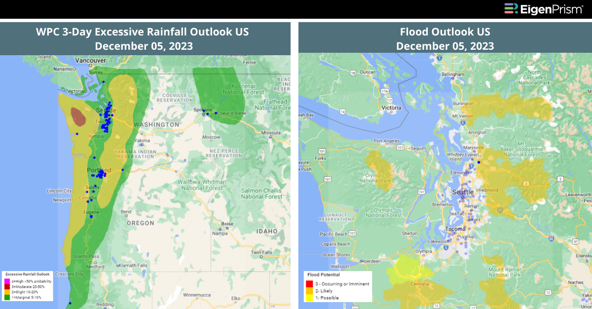
Pacific Northwest Faces Severe Flood Risk from Intense Atmospheric River
A strong atmospheric river, part of a series of storms, is striking the Pacific Northwest, causing a severe weather emergency. Since late Monday, the region has received over half a foot of rain, significantly increasing flood risks in an already saturated area.
This week’s atmospheric river has been classified as Level 4, or ‘extreme,’ for Oregon’s coastline and Level 3, or ‘strong,’ for Washington’s coast. The heaviest rainfall is more likely to affect coastal regions and the Cascade Mountains, potentially exceeding a foot in some areas.
The initial atmospheric river over this week will soak Washington, Oregon, and California with over 4 inches of rain. It will saturate the ground and lead to heavy snow in the Cascades and northern Rockies.
Avalanche risks are high from heavy rain on mountain snow, and landslides are a concern in wildfire areas. Storm activity may lessen by Thursday, but another atmospheric river is forecasted to impact the region by the weekend, with its effects becoming clearer after the event.
PACIFIC NORTHWEST SEVERE FLOOD RISK: ACTIONABLE INSIGHTS ON EIGENPRISM
To make timely decisions about this event, EigenPrism® users can assess the forecast using the following quick links:
- 72-Hr Forecast Freezing Rain Accumulation (90th Percentile) as of 2023-12-05
- 72-Hr Forecast Snow Accumulation (90th Percentile) as of 2023-12-05
- WPC 3-Day Excessive Rainfall Outlook as of 2023-12-05
- US Flood Outlook as of 2023-12-05
- 5-day Flood Potential as of 2023-12-04
- Landslide Potential as of 2023-12-04
Don’t have access to EigenPrism®?
Sign up for a trial account and access full impact reports of all events. Contact us and we’ll set up a trial account for you.