Winter Storm to Blast the Midwest with First Snow of the Season
The first winter storm of the season is on its way for regions across Dakota and Minnesota. Blizzard conditions are likely as winds increase to over 30 to 40 mph across this region, where temperatures will drop down to below average.
As per the Weather Prediction Center (WPC), heavy rain will fall on the warmer side of this storm system and eventually track through the Northeast by early weekend. WPC has issued a marginal risk warning (level 1 out of 4) for excessive rain on Friday. Rainfall totals will range between 1 to 2 inches through the early weekend. Still, localized accumulations could reach 2 to 4 inches across southern New England. Some of this rainfall could fall in only a matter of hours, increasing that risk for flash flooding.
Later, the wide-ranging and strengthening storm system is predicted to track east from Nebraska towards New York City.
Assessing the impact
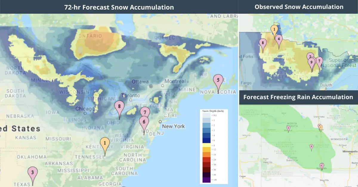
EigenPrism users can monitor the changing conditions with real-time access to the key perils associated with this storm system:
- 72-Hr Forecast Snow Accumulation – as of 2021-11-12
- 72-hour Observed Snow Accumulation – as of 2021-11-12
- 72-Hr Forecast Freezing Rain Accumulation (90th Percentile) – as of 2021-11-12
- 1-3 Day Potential Winter Storm Overall Impact – as of 2021-11-12
- Daily Peak Wind Gust across North America for Nov 12, 2021
Don’t have access to EigenPrism?
Sign-up for a trial account and access full impact reports of all events. Contact us and we’ll set up a trial account for you.